Last revised: 14 Dec 2012
The purposes of The First Families of Kentucky are to honor, preserve and promote the memories of the pioneer families that entered Kentucky prior to June 1, 1792.
Within the stated purpose, The First Families of Kentucky shall:
- Encourage interest in history, culture and traditions of the Commonwealth known as Kentucky;
- Collect genealogies and important history of the members of the Society and provide a permanent record for posterity;
- Sponsor Society events and foster a “feeling of kinship” among the descendants of The First Families of Kentucky.
The purposes are exclusively charitable, educational, literary, scientific and religious within the meanings of 501(c)7 of the Internal Revenue Code of 1954 or the corresponding provision of any future United States Internal Revenue law.
The period 1671 through and up to June 1, 1792 was chosen to include descendants of American colonists who explored or lived in Kentucky any time during that period.
But first, we may ask, what is Kanta-ke, the Indian word for Kentucky. A stretch of land below the Ohio River from Ashland to the mouth of the Ohio on the North. Bounded by the Western slopes of the Appalachians down to the Cumberland River just west of Cumberland Gap.
On the west, from the Ohio River mouth down to the topmost reach of Reelfoot lake and New Madrid. It was thought by the English and their American Colonists to be uninhabited at time of their exploration. It abounded with fur game and rich forest and cane growth. It was known as a dark and bloody hunting ground because while the Indians hunted there, they fought the other tribes for the privilege.
An examination of history shows that there was a continual contention among Indian tribes in Kanta-ke for centuries. Indians were living there when the Spaniards ofHernando de Soto explored it in 1539 to the mouth of the Ohio, with claims of course! The French were exploring New France as early as 1540 & 1599.
The Algonquin Indians, known to the early French and English explorers as Shanwans or Shawnees lived in Kanta-ke and all the NW Territory until the European diseases and expecially Small Pox traveled south with the Huron Indians. This devastated Kanta-keand the Shawnee survivors fled south to Tennessee, Georgia, Florida, and to territories west of the Mississippi. Some remained in Ohio.
Early French explorers attempted to establish colonies about 1608 (New France) underSamuel de Champlain. Champlain and other French traders forged alliances between France and the Huron & Ottawa against the Iroquois nations. They continued exploring the Great Lakes region and contributory rivers. They claimed Canada and the Great Lakes Region in 1663 as New France including the N.W. Territory bordering Kanta-ke. New France continued to grow south and west after 1673 (Fathers Jacques Marquetteand Louis Jolliet). Cavelier and La Salle traveled the Mississippi to its delta in 1682 and claimed its entire watershed (Including Kanta-ke) for New France.
In 1744, however, the Ohio tribes (the Algonquins and the Iroqouoians signed a treaty to give up their ties to New France. This was the Treaty of Lancaster, Pa. to which Pennsylvania, Virginia and Maryland were parties . His majesty George II then legally owned the land from the Tidewater to the Mississippi. However the Shawnee held out until defeated in 1813 at the battle on the Thames.
Interestingly enough, French Capt. Pierre Celeron de Bienville buried metal claim plates at the mouth of the Ohio and along its shores toward the river sources in 1749 as a monument to renewal of possession of the Ohio river and all streams and lands on both sides, even to the sources…by force of arms and by treaties, especially by Ryswick, Utrecht and Aix-la-Chapelle. This was tantamount to an act of war.American Colonists Exploration of Kanta-ke.
It begins with Explorer Thomas Batte, who entered Kentucky on Sept. 1, 1671. Thomas Batte, Robert Fallows and Thomas Wood received a commission from Major General Abraham Wood of Virginia for “finding out the ebbing and flowing of the waters on the other side of the Blue Ridge Mountains”, which included what is now called Kentucky. Dr. Lewis Preston Summers, in his book, Annals of Southwest Virginia, provides their journal of the expedition. See story in The Kentuckian, Vol. 1, No.1.
The next major exploration was the Dr. Thomas Walker party from Virginia in 1750. Dr. Walker was employed by the Loyal Land Company of Virginia to locate a boundary for 800,000 acres suitable for development in the western reaches of Virginia. See extract from their journal in The Kentuckian, Vol. 1, No.2.
The map in the Kentuckian Vol. 1 No. 1 (p.3) shows the County of Kentucky to be derived from Virginia Colony’s Old Botetourt County. Consequently the County of Kentucky was formed in 1777 from Fincastle Co. which was formed in 1772 from Botetourt Co. which was formed in 1770 from the western part of the Virginia Colony.
Dr. Walker’s party built the first house just west of Barbourville on the banks of the Cumberland River in 1750 and so claimed for the Loyal Land Company of Va. the rights thereto. The rivalry between Loyal and other land companies in Va. (the Ohio Company and Christopher Gist, and the Greenbrier Co.) was tense so prompt exploration was a must. Gist left for his 1200 mile odyssey in Sept. of 1750 but didn’t return until 1752 after he was directed to conclude the Logstown Treaty to reinforce the 1744 Treaty of Lancaster.
During the French and Indian Wars (1754-1763) the French and the Shawnee fought against the English who used the Iroquois Nations as allies. This ruckus was over the lucrative fur trade and the Bienville metal plate plants reclaiming the territory for France in 1749.
This led to the French and Indian wars with the Shawnee on the side of the French which openly occurred 1753 to 1763.
Following the French defeat in the French and Indian Wars , the treaty of Paris of February 10, 1763 divided French territory between the British and the Spanish. France was able to regain some of their former North American possessions from the Spanish in 1800 (Treaty of San Ildefonso) but then sold the entire Louisiana territory to the U.S. (Louisiana Purchase). Kanta-ke of course went with the colony of Virginia under the British Crown from 1763 until 1783.
From earlier times, the Shawnee regarded Kanta-ke as a sacred hunting ground and by treaty with surrounding tribes, Chicasaw, Choctaw, Cherokee, Catawba, Creek and others hunted but never settled there again.
After the 1763 Treaty of Paris, the Shawnee were persuaded to locate in Ohio, and the war being over, left Kanta-ke empty of hunting parties.
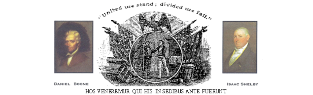
Hence, American hide & fur hunters from the American colonies took advantage to become the Long Hunters. Shortly thereafter, the Virginia Long Hunters made history in the fur trade exploring the western slopes and Kentucky about which many books have been written. (Belue-The Hunters of Kentucky, ex.). Daniel and brother Squire Boone first started hunting in Kanta-ke in 1765. Some of the regular Long Hunters were Capt. James Smith, Uriah Stone, Abraham and Isaac Bledsoe, Caspar Mansker, Obadiah Terril, John Baker, Joseph Drake, Ned Cowan, Henry Smith, and John Rains. In 1769 they were joined by Col. James Knox, Henry Skaggs and James Dysart. Daniel Boone, Squire Boone, Benjamin Croley, and Samuel Croley met and traveled with them. William Miller and Tom Hardeman were back for a second season. John Stewart and John Findlay were also there.
There are many other Long Hunters too numerous to name here. Simon Kenton is one of the most famous.
Enter another element: A well known truth: For each militia stint in the French and Indian Wars, Virginians had earned warrants redeemable in public land. An Ensign got one thousand acres; a Sergeant received 200 acres and each Private, 50.
The lure of land had swelled county levies with hungry fighters willing to die for farms in the West. Kanta-ke beckoned to several of the colonies. Hence, a plot with Gov. Dunmore was hatched for Virginia to act quickly for their militia veterans. In 1772, Capt. Thomas Bullitt proposed a foray into the western waters to mark off land grants for veterans. Everybody knew it was a violation of the 1763 treaty and the Treaty of Hard Labor, 1768. Also, Dunmore had a large number of exaggerated war circulars stating that the Shawnee Indians were ill disposed to white men and everyone should take up arms. Word was Dunmore himself would receive 10,000 or more acres for supporting it. Bullitt’s flotilla left 7 months later to float down to Louisville and lay out 5 towns (1773). Bullitt’s surveys were not done by Fincastle surveyors so the Fincastle people sent out their own teams. (under Capt. John Floyd).
Unfortunately, those circulars stirred up the settlers who killed some Indians who then killed some settlers and started up hostilities again. Quite a bit of damage was done to both sides.
In 1771 a band of Cherokees accosted the homeward bound Boones and robbed them of all their skins. In 1773, the Boones tried to take 5 Yadkin River families to found Ft. Boonesborough for the Henderson Co.. The Cherokees hit them in Powell’s Valley on Oct. 9 and murdered several young boys, including Daniel Boone’s son James.They all turned back to N.C.
By the summer of 1774, Col. Preston of Fincastle Co. became greatly concerned about the safety of Capt. John Floyd’s Survey team . They had come across James Harrod’s party site that had been attacked and left a note pointing to the way they had gone. Scouts were dispatched to warn the surveyors to return to base. These scouts were Daniel Boone and Michael Stoner. They found them after an 800 mile search and helped most to escape.
October 10, 1774, Lord Dunmore’s war at Pt. Pleasant erupted killing about 75 militia and an unknown no. of Indians. The Shawnee were defeated and began the withdrawal to Ohio and westward. Hostilities continued until 1813 when the Shawnee lost Tecumseh at the battle of Fallen Timbers.
In 1775, Daniel Boone led some 40 families to Ft. Boonesborough for the Henderson Co. which had purchased sizable tracts from the Cherokee.
In 1777, about 200 Shawnee besieged Ft. Boonesborough. The siege was broken.
In 1778, about 400 Shawnee and their allies together with 33 British besieged Ft. Boonesborough. That siege was also broken.
In 1780, the settlers of Ft. Boonesborough and Bryan’s station discovered that their land claims through the Henderson Co were worthless, as the land had been pre-empted by another land company. Many families went back to Virginia and North Carolina.
The Kentucky Militia under Gen. George Rogers Clark and with help of Col. Benjamin Logan and Captain John Holder, then carried the war to the Shawnee in Ohio and gradually shut down the marauders in successful campaigns. We still had Bryan’s Station, Floyds Defeat and Blue Licks to endure but after 1782 our settlers became well protected and began working toward statehood. We had just 10 years to get ready!
During the remainder of the years until statehood, Kentucky was devastated by the Shawnee and their allies. In all, from 1753 on, some 2500 Kentucky Settlers were killed before the hostilities ended.
We have given you some of the history of Kentucky so that it is not taken for granted; that our ancestors endured great hardships and high peril to claim this place you call home, and also how we came to be under six flags.
We hope that you will be inspired to tell the story of your earliest ancestor, which we will be glad to publish for the enjoyment of your fellow members. –Editor